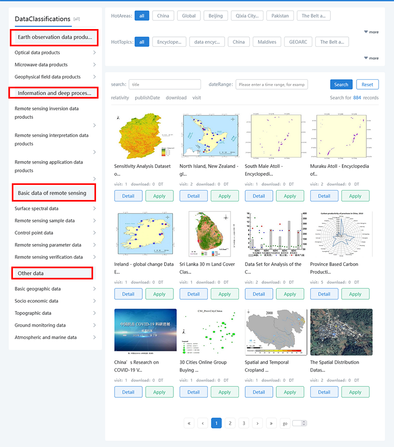
The home page of the data discovery platform shows some data products, which are divided into four different types: [Earth observation data products], [Information deep processing data], [Remote sensing data], and [Other data]. You can view the data you are interested in under the headings of different data types, and click the "More>" button to access more data resources of the same type that are not displayed on the home page.

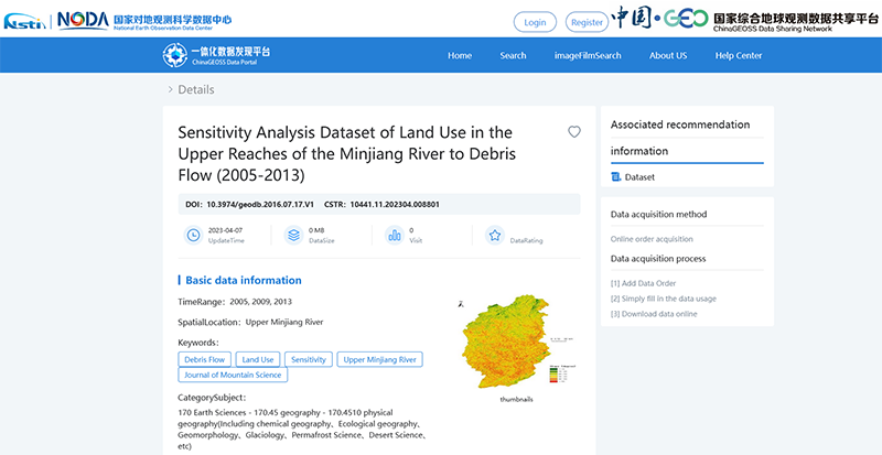
Click the "View Data" button to jump to the dataset details page to view the details of the selected dataset, Including [Basic Data Information], [Contact Information], [Data Summary], [Data Reference Method and Statement], etc


Click the "Online Application" button to add the selected dataset to the account shopping cart as an order. The data resources of this platform are divided into online resources and offline resources. After the online resource is added to the shopping cart, it can be downloaded directly. Offline resources can only be downloaded after being approved by the system administrator.

1.Data filtering items: In the top interface of the data set retrieval topic, you can click three different types of data filtering items: spatial location, data format, and data type to update the corresponding data set information on the page
2.Precise data search: The data discovery platform provides the function of precise filter condition search, which can update the specific data set you need in the page through keyword filtering and time range filtering. Enter the keyword/time range information in the search box and click the "Search" button to query the dataset information related to the data classification.
3.Sorting Method: sorting by dataset relevance by default. Click "Name" to sort by dataset relevance (consistent with the default sorting method). Click the "Update Time" button to sort the data sets in descending order of the time they were collected on the data platform; Click "Downloads" or "Visits" to sort by the number of downloads or visits to the dataset in descending order
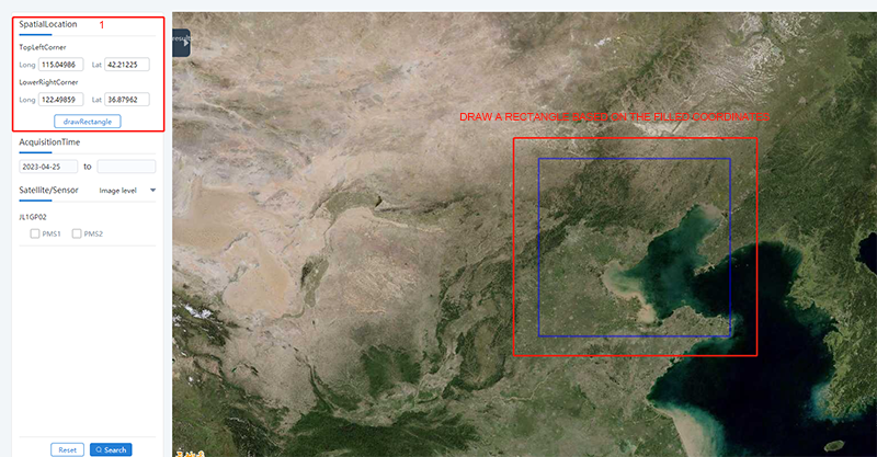

The image product retrieval module provides two image retrieval methods: manual input of longitude and latitude and frame selection of image space range. In manual mode, you need to enter "To be" in the search box Query the longitude and latitude of the upper left corner and lower right corner of the area, and the system will automatically draw the space range you provide on the map as a reference. In the box selection mode, you can click to draw the image range you need in the map on the right, The system will generate corresponding longitude and latitude coordinates. With these two methods, you can filter out various remote sensing image resources including the selection box according to your needs.

1.After selecting the required image space range, click the "Query" button to search all remote sensing images on this platform that include this range.
2. This platform provides the function of image precise search, which can select specific remote sensing images according to the characteristics of "acquisition time", "data type", "satellite/sensor", etc.
3. In the query results, you can see the total number of entries of the queried image data and the basic information of each image. In this section, you can browse all the filtered images, and Add the required single image to the shopping cart or further view its details.
4.Click the "Reset" button to clear all the currently retrieved filter items and image boxes, and you can continue to search for the desired remote sensing image.